Rupture 81798
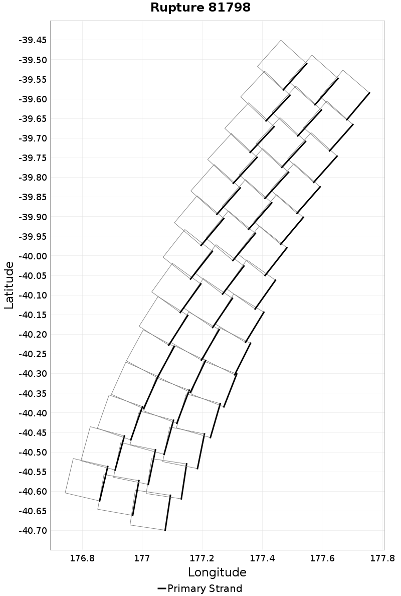
| Length (km) | Magnitude | # Subsections | # Clusters | Area (km^2) |
|---|---|---|---|---|
| 139.9 | 7.3 | 42 | 1 | 4,195.9 |
| Maximum Jump Distance (km) | Cumulative Jump Distance (km) | Ideal Length Ratio | Ideal Length Difference | Rake (degrees) |
| 0.0 | 0.0 | 1 | 1.7 | 0.0 |
| Cumulative Rake Change (degrees) | # Mechanism Changes | Cumulative Azimuth Change (degrees) | BS '16-'17 Prob | |
| 0.0 | 0.0 | 821.6 | 1 |
Text representation:
[10000:731,756,781,806,831,855,879,903,926,949,972,995,1017,1039,732,757,782,807,832,856,880,904,927,950,973,996,1018,1040,733,758,783,808,833,857,881,905,928,951,974,997,1019,1041]
Fault section list. First section listed is South West relative to the last section.
- Hikurangi, Kermadec to Louisville ridge, 10km - with slip deficit flattened near east cape
- 731, 756, 781, 806, 831, 855, 879, 903, 926, 949, 972, 995, 1017, 1039, 732, 757, 782, 807, 832, 856, 880, 904, 927, 950, 973, 996, 1018, 1040, 733, 758, 783, 808, 833, 857, 881, 905, 928, 951, 974, 997, 1019, 1041