Rupture 22491
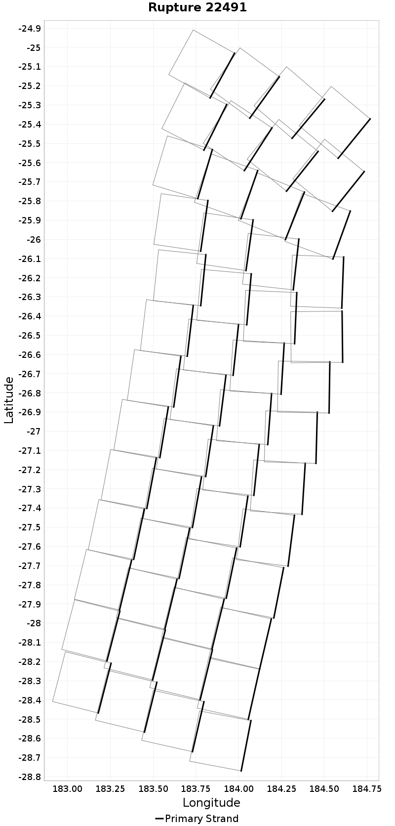
| Length (km) | Magnitude | # Subsections | # Clusters | Area (km^2) |
|---|---|---|---|---|
| 385.2 | 8.4 | 52 | 1 | 46,273.9 |
| Maximum Jump Distance (km) | Cumulative Jump Distance (km) | Ideal Length Ratio | Ideal Length Difference | Rake (degrees) |
| 0.0 | 0.0 | 0.92628425 | -30.7 | 0.0 |
| Cumulative Rake Change (degrees) | # Mechanism Changes | Cumulative Azimuth Change (degrees) | BS '16-'17 Prob | |
| 0.0 | 0.0 | 1,210.7 | 1 |
Text representation:
[10000:364,369,374,379,384,389,394,400,406,412,418,424,430,365,370,375,380,385,390,395,401,407,413,419,425,431,366,371,376,381,386,391,396,402,408,414,420,426,432,367,372,377,382,387,392,397,403,409,415,421,427,433]
Fault section list. First section listed is South East relative to the last section.
- Hikurangi, Kermadec to Louisville ridge, 30km - with slip deficit flattened near east cape
- 364, 369, 374, 379, 384, 389, 394, 400, 406, 412, 418, 424, 430, 365, 370, 375, 380, 385, 390, 395, 401, 407, 413, 419, 425, 431, 366, 371, 376, 381, 386, 391, 396, 402, 408, 414, 420, 426, 432, 367, 372, 377, 382, 387, 392, 397, 403, 409, 415, 421, 427, 433