Rupture 170430
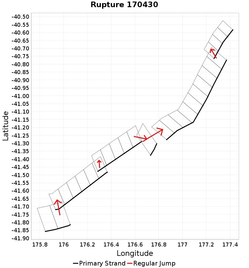
| Length (km) | Magnitude | # Subsections | # Clusters | Area (km^2) |
|---|---|---|---|---|
| 205.9 | 7.4 | 28 | 6 | 3,280 |
| Maximum Jump Distance (km) | Cumulative Jump Distance (km) | Ideal Length Ratio | Ideal Length Difference | Rake (degrees) |
| 4.9 | 17 | 1.1 | 12.3 | -90 |
| Cumulative Rake Change (degrees) | # Mechanism Changes | Cumulative Azimuth Change (degrees) | BS '16-'17 Prob | |
| 0.0 | 0.0 | 538.3 | 9.1317145E-4 |
Text representation:
[164:1016,1015][446:2468,2469,2470,2471,2472,2473][426:2374,2375,2376,2377,2378][487:2751][474:2653,2652,2651,2650,2649,2648,2647,2646,2645,2644][473:2630,2631,2632,2633]
Fault section list. First section listed is South West relative to the last section.
- Glendhu Ridge
- 1016, 1015 (jump to 2468, 4.9km)
- Pahaua
- 2468, 2469, 2470, 2471, 2472, 2473 (jump to 2374, 2.7km)
- Opouawe - Uruti
- 2374, 2375, 2376, 2377, 2378 (jump to 2751, 2.9km)
- Pukeroro 2
- 2751 (jump to 2653, 3.9km)
- Porangahau Basin
- 2653, 2652, 2651, 2650, 2649, 2648, 2647, 2646, 2645, 2644 (jump to 2630, 2.6km)
- PorWest2 - PaoanuiRSouth
- 2630, 2631, 2632, 2633