Rupture 812201
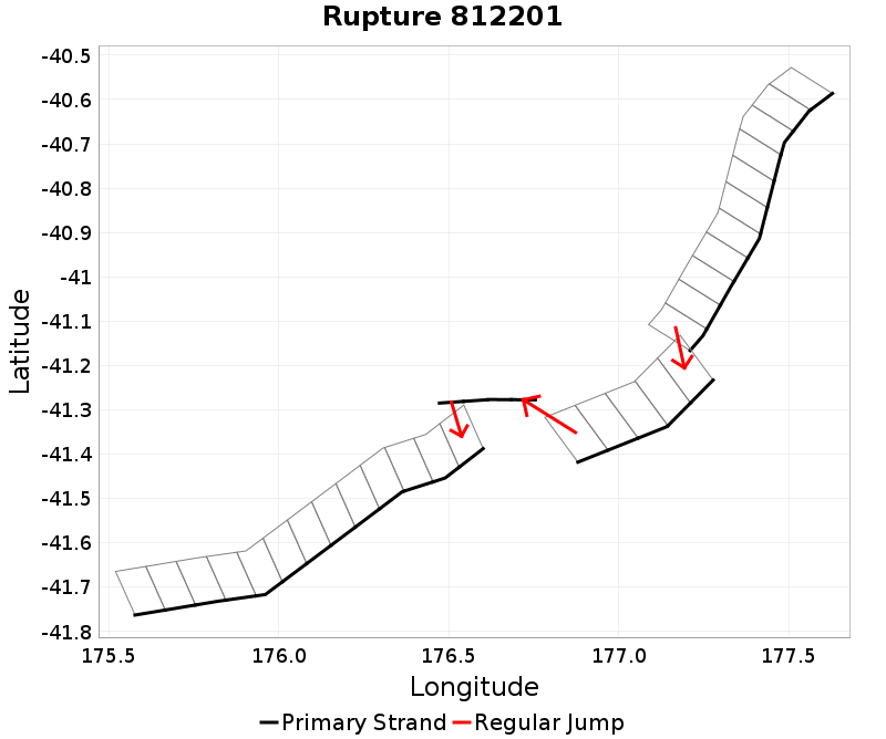
| Length (km) | Magnitude | # Subsections | # Clusters | Area (km^2) |
|---|---|---|---|---|
| 236 | 7.5 | 33 | 4 | 3,511.8 |
| Maximum Jump Distance (km) | Cumulative Jump Distance (km) | Ideal Length Ratio | Ideal Length Difference | Rake (degrees) |
| 5 | 10.6 | 1.1 | 20.1 | -84.5 |
| Cumulative Rake Change (degrees) | # Mechanism Changes | Cumulative Azimuth Change (degrees) | BS '16-'17 Prob | |
| 180 | 2 | 503.8 | 2.911763E-4 |
Text representation:
[476:2675,2676,2677,2678,2679,2680,2681,2682,2683,2684,2685][27:236,237,238,239,240][613:3421,3420,3419,3418][446:2476,2475,2474,2473,2472,2471,2470,2469,2468,2467,2466,2465,2464]
Fault section list. First section listed is North East relative to the last section.
- Porangahau Ridge
- 2675, 2676, 2677, 2678, 2679, 2680, 2681, 2682, 2683, 2684, 2685 (jump to 236, 4.7km)
- Aorangi Trough
- 236, 237, 238, 239, 240 (jump to 3421, 5km)
- Uruti Basin
- 3421, 3420, 3419, 3418 (jump to 2476, 0.9km)
- Pahaua
- 2476, 2475, 2474, 2473, 2472, 2471, 2470, 2469, 2468, 2467, 2466, 2465, 2464