Rupture 16397
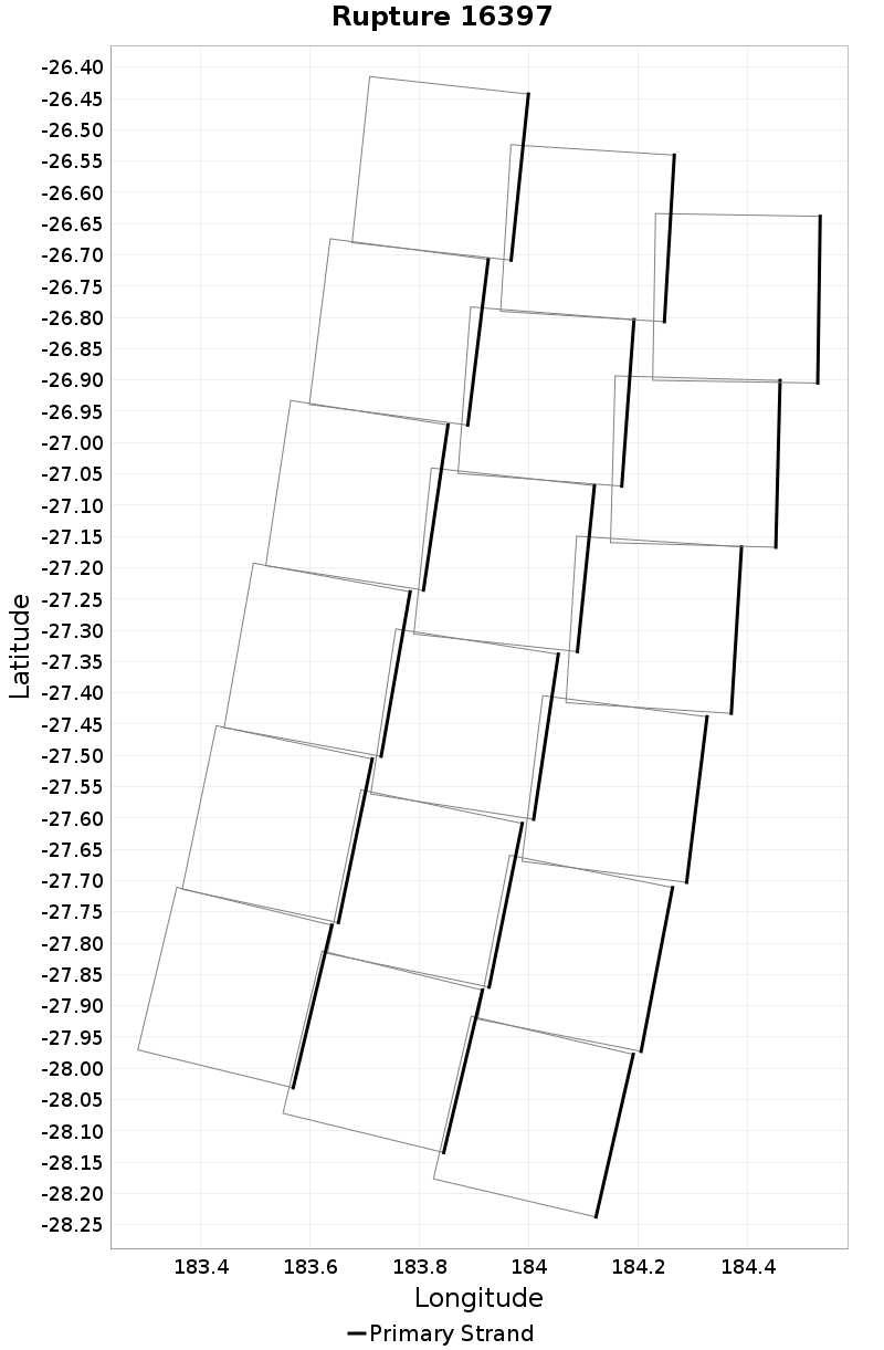
| Length (km) | Magnitude | # Subsections | # Clusters | Area (km^2) |
|---|---|---|---|---|
| 177.9 | 7.9 | 18 | 1 | 16,021.3 |
| Maximum Jump Distance (km) | Cumulative Jump Distance (km) | Ideal Length Ratio | Ideal Length Difference | Rake (degrees) |
| 0.0 | 0.0 | 0.8898366 | -22 | 0.0 |
| Cumulative Rake Change (degrees) | # Mechanism Changes | Cumulative Azimuth Change (degrees) | BS '16-'17 Prob | |
| 0.0 | 0.0 | 688.3 | 1 |
Text representation:
[10000:374,379,384,389,394,400,375,380,385,390,395,401,376,381,386,391,396,402]
Fault section list. First section listed is South East relative to the last section.
- Hikurangi, Kermadec to Louisville ridge, 30km - with slip deficit flattened near east cape
- 374, 379, 384, 389, 394, 400, 375, 380, 385, 390, 395, 401, 376, 381, 386, 391, 396, 402