Rupture 292671
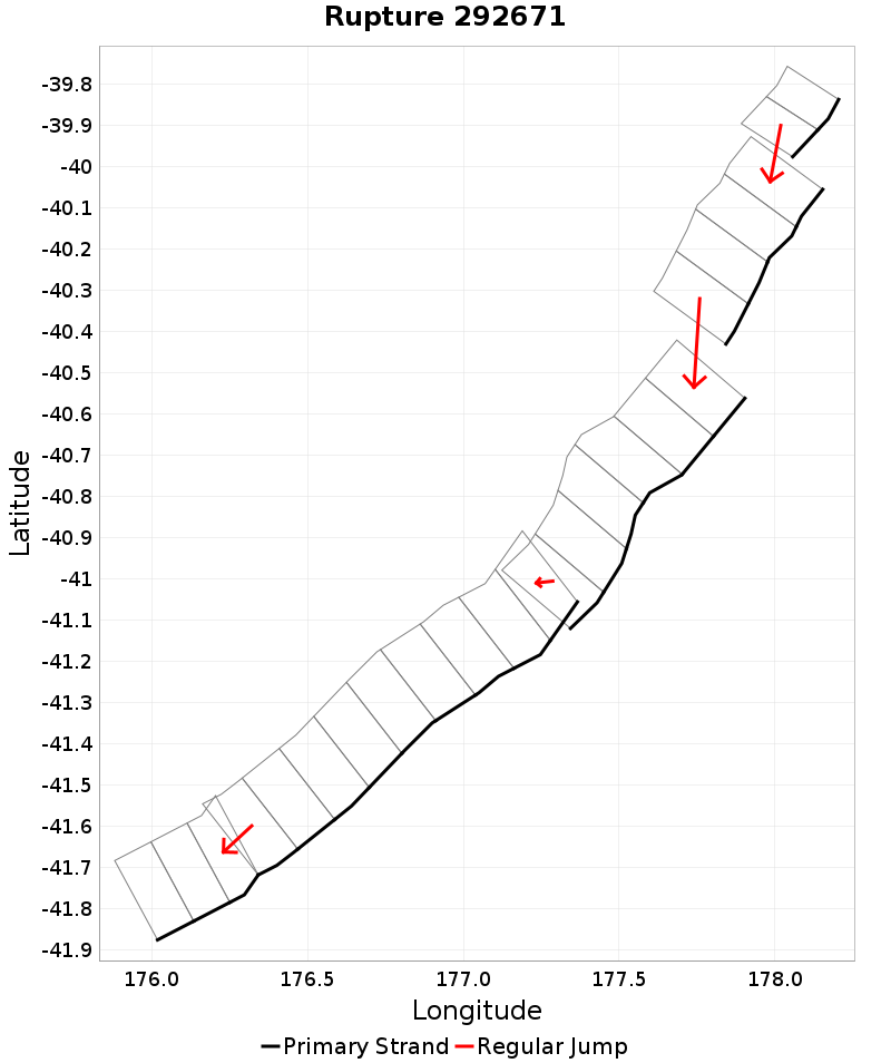
| Length (km) | Magnitude | # Subsections | # Clusters | Area (km^2) |
|---|---|---|---|---|
| 296.6 | 7.9 | 24 | 5 | 8,180.2 |
| Maximum Jump Distance (km) | Cumulative Jump Distance (km) | Ideal Length Ratio | Ideal Length Difference | Rake (degrees) |
| 9.5 | 13.5 | 1 | 4.7 | -90 |
| Cumulative Rake Change (degrees) | # Mechanism Changes | Cumulative Azimuth Change (degrees) | BS '16-'17 Prob | |
| 0.0 | 0.0 | 343.1 | 0.027041975 |
Text representation:
[522:2031,2030][475:1871,1872,1873,1874][6:26,25,24,23,22,21][488:1940,1939,1938,1937,1936,1935,1934,1933,1932][197:803,804,805]
Fault section list. First section listed is North East relative to the last section.
- Ritchie West 1
- 2031, 2030 (jump to 1871, 3.1km)
- Porangahau Northeast
- 1871, 1872, 1873, 1874 (jump to 26, 9.5km)
- Akitio Trough West
- 26, 25, 24, 23, 22, 21 (jump to 1940, 0.9km)
- Pukeroro Ridge
- 1940, 1939, 1938, 1937, 1936, 1935, 1934, 1933, 1932 (jump to 803, 0km)
- Honeycomb Ridge
- 803, 804, 805