Rupture 293629
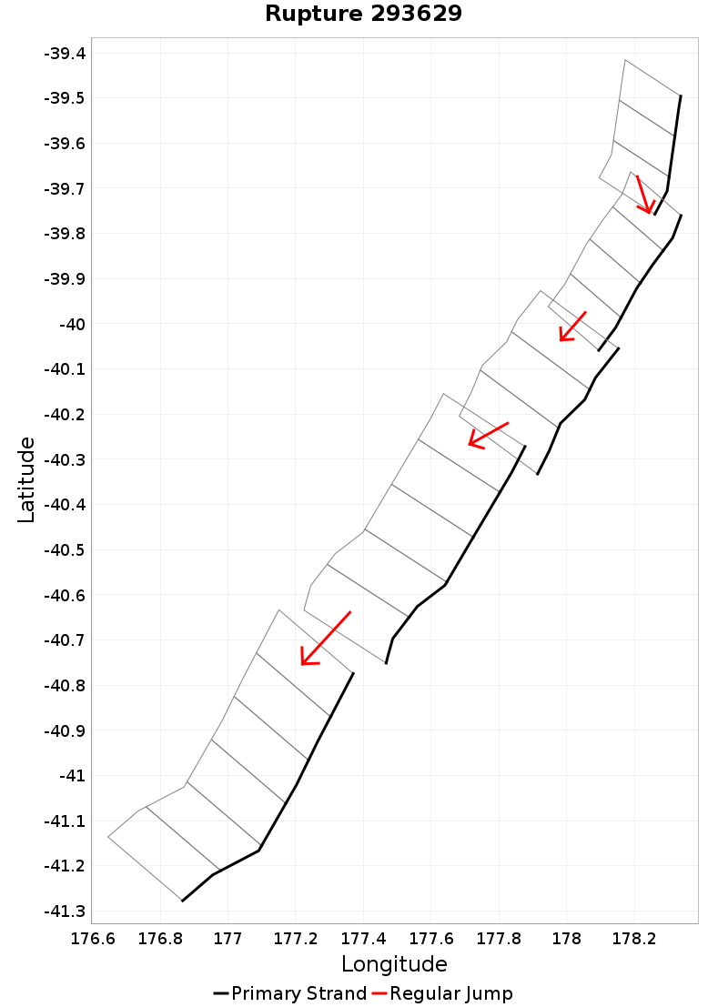
| Length (km) | Magnitude | # Subsections | # Clusters | Area (km^2) |
|---|---|---|---|---|
| 243.4 | 7.7 | 21 | 5 | 6,383.6 |
| Maximum Jump Distance (km) | Cumulative Jump Distance (km) | Ideal Length Ratio | Ideal Length Difference | Rake (degrees) |
| 4.7 | 11.9 | 1 | 9.4 | -90 |
| Cumulative Rake Change (degrees) | # Mechanism Changes | Cumulative Azimuth Change (degrees) | BS '16-'17 Prob | |
| 0.0 | 0.0 | 232.8 | 0.010005531 |
Text representation:
[522:2035,2034,2033][455:1789,1790,1791,1792][475:1871,1872,1873][476:1879,1880,1881,1882,1883][474:1865,1866,1867,1868,1869,1870]
Fault section list. First section listed is North East relative to the last section.
- Ritchie West 1
- 2035, 2034, 2033 (jump to 1789, 3.9km)
- Paoanui Ridge North
- 1789, 1790, 1791, 1792 (jump to 1871, 0.4km)
- Porangahau Northeast
- 1871, 1872, 1873 (jump to 1879, 3km)
- Porangahau Ridge
- 1879, 1880, 1881, 1882, 1883 (jump to 1865, 4.7km)
- Porangahau Basin
- 1865, 1866, 1867, 1868, 1869, 1870