Rupture 203073
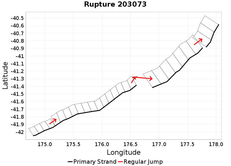
| Length (km) | Magnitude | # Subsections | # Clusters | Area (km^2) |
|---|---|---|---|---|
| 307.9 | 7.8 | 29 | 5 | 7,054.3 |
| Maximum Jump Distance (km) | Cumulative Jump Distance (km) | Ideal Length Ratio | Ideal Length Difference | Rake (degrees) |
| 9.9 | 11.7 | 0.97444504 | -8.1 | -85.6 |
| Cumulative Rake Change (degrees) | # Mechanism Changes | Cumulative Azimuth Change (degrees) | BS '16-'17 Prob | |
| 225 | 3 | 312.2 | 1.5529402E-5 |
Text representation:
[250:998,997,996,995][446:1742,1743,1744,1745,1746,1747,1748,1749,1750,1751,1752,1753,1754,1755][613:2362][27:153,152,151,150,149,148,147][5:20,19,18]
Fault section list. First section listed is South West relative to the last section.
- Kekerengu Bank
- 998, 997, 996, 995 (jump to 1742, 0km)
- Pahaua
- 1742, 1743, 1744, 1745, 1746, 1747, 1748, 1749, 1750, 1751, 1752, 1753, 1754, 1755 (jump to 2362, 0.3km)
- Uruti Basin
- 2362 (jump to 153, 9.9km)
- Aorangi Trough
- 153, 152, 151, 150, 149, 148, 147 (jump to 20, 1.5km)
- Akitio Ridge
- 20, 19, 18