Rupture 563720
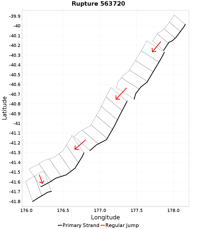
| Length (km) | Magnitude | # Subsections | # Clusters | Area (km^2) |
|---|---|---|---|---|
| 264.3 | 7.8 | 22 | 5 | 7,150.6 |
| Maximum Jump Distance (km) | Cumulative Jump Distance (km) | Ideal Length Ratio | Ideal Length Difference | Rake (degrees) |
| 4.7 | 12.6 | 0.9912278 | -2.3 | -90 |
| Cumulative Rake Change (degrees) | # Mechanism Changes | Cumulative Azimuth Change (degrees) | BS '16-'17 Prob | |
| 0.0 | 0.0 | 320.1 | 0.0037020463 |
Text representation:
[455:1792,1793,1794,1795][476:1879,1880,1881,1882,1883][474:1865,1866,1867,1868,1869,1870][487:1927,1928,1929,1930,1931][164:685,686]
Fault section list. First section listed is North East relative to the last section.
- Paoanui Ridge North
- 1792, 1793, 1794, 1795 (jump to 1879, 1.7km)
- Porangahau Ridge
- 1879, 1880, 1881, 1882, 1883 (jump to 1865, 4.7km)
- Porangahau Basin
- 1865, 1866, 1867, 1868, 1869, 1870 (jump to 1927, 1.6km)
- Pukeroro 2
- 1927, 1928, 1929, 1930, 1931 (jump to 685, 4.6km)
- Glendhu Ridge
- 685, 686