Rupture 223406
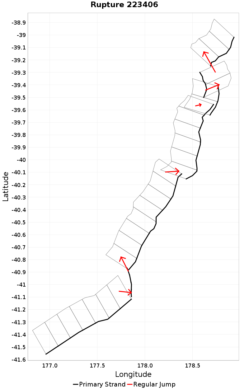
| Length (km) | Magnitude | # Subsections | # Clusters | Area (km^2) |
|---|---|---|---|---|
| 380.6 | 8 | 32 | 7 | 10,292.1 |
| Maximum Jump Distance (km) | Cumulative Jump Distance (km) | Ideal Length Ratio | Ideal Length Difference | Rake (degrees) |
| 5.1 | 11.4 | 1.2 | 52.3 | -92.1 |
| Cumulative Rake Change (degrees) | # Mechanism Changes | Cumulative Azimuth Change (degrees) | BS '16-'17 Prob | |
| 180 | 2 | 878.8 | 5.905487E-6 |
Text representation:
[139:588,589,590,591,592,593,594][43:235,236,237,238][5:20,19,18,17,16,15,14,13][529:2065,2064,2063,2062,2061,2060][451:1774,1775][577:2246,2247][484:1916,1915,1914]
Fault section list. First section listed is South West relative to the last section.
- F17 - South
- 588, 589, 590, 591, 592, 593, 594 (jump to 235, 1.1km)
- BKSmt-West
- 235, 236, 237, 238 (jump to 20, 0.5km)
- Akitio Ridge
- 20, 19, 18, 17, 16, 15, 14, 13 (jump to 2065, 3.3km)
- Rock Garden - Ritchie East 1
- 2065, 2064, 2063, 2062, 2061, 2060 (jump to 1774, 1.3km)
- Pakupaku Ridge
- 1774, 1775 (jump to 2246, 0.1km)
- Te Kapu Bank
- 2246, 2247 (jump to 1916, 5.1km)
- Puke Knoll
- 1916, 1915, 1914