Rupture 355689
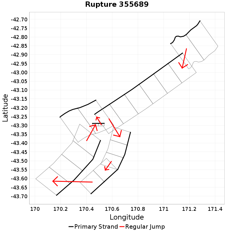
| Length (km) | Magnitude | # Subsections | # Clusters | Area (km^2) |
|---|---|---|---|---|
| 217.1 | 7.7 | 21 | 7 | 5,233.1 |
| Maximum Jump Distance (km) | Cumulative Jump Distance (km) | Ideal Length Ratio | Ideal Length Difference | Rake (degrees) |
| 12.4 | 20.2 | 1.5 | 75.1 | -48.1 |
| Cumulative Rake Change (degrees) | # Mechanism Changes | Cumulative Azimuth Change (degrees) | BS '16-'17 Prob | |
| 240 | 2 | 719.3 | 2.7344873E-5 |
Text representation:
[193:790,789][18:95,94,93,92,91,90][619:2384,2385,2386][301:1217,1218][363:1450,1449,1448,1447][354:1424,1425][193:783,782]
Fault section list. First section listed is North East relative to the last section.
- Hohonu South
- 790, 789 (jump to 95, 2.6km)
- Alpine: Jacksons to Kaniere
- 95, 94, 93, 92, 91, 90 (jump to 2384, 0.5km)
- Veil Stream
- 2384, 2385, 2386 (jump to 1217, 0.1km)
- Macaulay 2
- 1217, 1218 (jump to 1450, 12.4km)
- Murchison 1 - Ice Lake
- 1450, 1449, 1448, 1447 (jump to 1424, 4.6km)
- Mt Adams
- 1424, 1425 (jump to 783, 0.1km)
- Hohonu South
- 783, 782