Rupture 125844
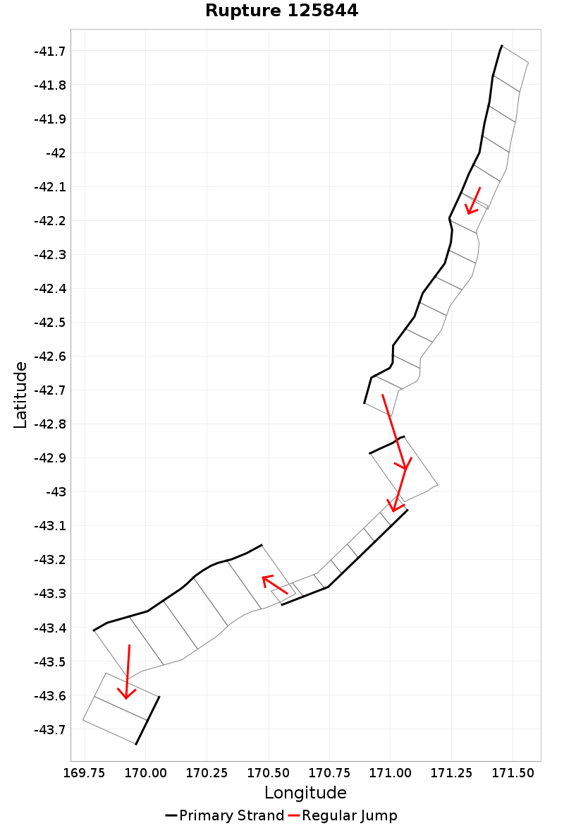
| Length (km) | Magnitude | # Subsections | # Clusters | Area (km^2) |
|---|---|---|---|---|
| 275.5 | 7.7 | 28 | 6 | 5,951 |
| Maximum Jump Distance (km) | Cumulative Jump Distance (km) | Ideal Length Ratio | Ideal Length Difference | Rake (degrees) |
| 14.5 | 18.5 | 1.1 | 16.2 | -82.1 |
| Cumulative Rake Change (degrees) | # Mechanism Changes | Cumulative Azimuth Change (degrees) | BS '16-'17 Prob | |
| 60 | 1 | 535 | 4.6255934E-4 |
Text representation:
[73:346,347,348,349,350][72:340,339,338,337,336,335,334,333][193:788][297:1196,1197,1198,1199,1200,1201,1202][193:783,782,781,780,779][332:1327,1328]
Fault section list. First section listed is North East relative to the last section.
- Cape Foulwind 2
- 346, 347, 348, 349, 350 (jump to 340, 0km)
- Cape Foulwind 1
- 340, 339, 338, 337, 336, 335, 334, 333 (jump to 788, 14.5km)
- Hohonu South
- 788 (jump to 1196, 1.2km)
- Lord Range
- 1196, 1197, 1198, 1199, 1200, 1201, 1202 (jump to 783, 0.3km)
- Hohonu South
- 783, 782, 781, 780, 779 (jump to 1327, 2.6km)
- McKerrow - Douglas Duplex
- 1327, 1328