Rupture 467577
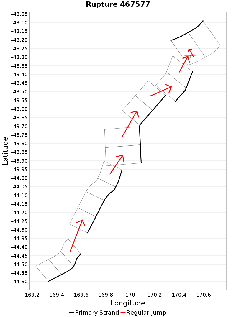
| Length (km) | Magnitude | # Subsections | # Clusters | Area (km^2) |
|---|---|---|---|---|
| 179.3 | 7.6 | 17 | 7 | 4,740.6 |
| Maximum Jump Distance (km) | Cumulative Jump Distance (km) | Ideal Length Ratio | Ideal Length Difference | Rake (degrees) |
| 9.3 | 20.2 | 0.9152614 | -16.6 | -77.5 |
| Cumulative Rake Change (degrees) | # Mechanism Changes | Cumulative Azimuth Change (degrees) | BS '16-'17 Prob | |
| 220 | 4 | 472.5 | 1.4525597E-7 |
Text representation:
[588:2280,2279,2278][48:253,252,251,250][168:699,700][56:278,277][363:1448,1447][354:1424,1425][193:783,784]
Fault section list. First section listed is South West relative to the last section.
- Timaru Creek
- 2280, 2279, 2278 (jump to 253, 9.3km)
- Barrier Range
- 253, 252, 251, 250 (jump to 699, 1.3km)
- Great Groove
- 699, 700 (jump to 278, 0.9km)
- Black Blob - Haast Ridge
- 278, 277 (jump to 1448, 4km)
- Murchison 1 - Ice Lake
- 1448, 1447 (jump to 1424, 4.6km)
- Mt Adams
- 1424, 1425 (jump to 783, 0.1km)
- Hohonu South
- 783, 784