Rupture 870873
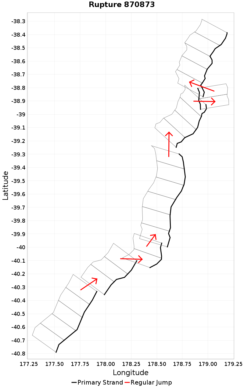
| Length (km) | Magnitude | # Subsections | # Clusters | Area (km^2) |
|---|---|---|---|---|
| 340.5 | 7.9 | 27 | 7 | 9,534.8 |
| Maximum Jump Distance (km) | Cumulative Jump Distance (km) | Ideal Length Ratio | Ideal Length Difference | Rake (degrees) |
| 6.3 | 18.3 | 1.1 | 37.3 | -90 |
| Cumulative Rake Change (degrees) | # Mechanism Changes | Cumulative Azimuth Change (degrees) | BS '16-'17 Prob | |
| 0.0 | 0.0 | 774.4 | 8.22677E-4 |
Text representation:
[475:1878,1877,1876,1875,1874][528:2059,2058,2057][529:2065,2064][451:1771,1772,1773,1774,1775,1776][484:1916,1915,1914,1913][456:1796,1797][485:1918,1919,1920,1921,1922]
Fault section list. First section listed is South West relative to the last section.
- Porangahau Northeast
- 1878, 1877, 1876, 1875, 1874 (jump to 2059, 3.7km)
- Rock Garden - Ritchie East
- 2059, 2058, 2057 (jump to 2065, 6.3km)
- Rock Garden - Ritchie East 1
- 2065, 2064 (jump to 1771, 2.7km)
- Pakupaku Ridge
- 1771, 1772, 1773, 1774, 1775, 1776 (jump to 1916, 5.1km)
- Puke Knoll
- 1916, 1915, 1914, 1913 (jump to 1796, 0.4km)
- Papaku
- 1796, 1797 (jump to 1918, 0.2km)
- Puke Ridge
- 1918, 1919, 1920, 1921, 1922