Rupture 170475
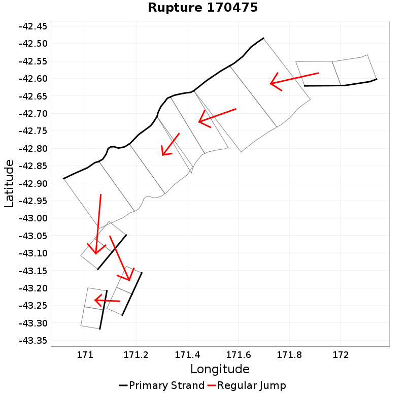
| Length (km) | Magnitude | # Subsections | # Clusters | Area (km^2) |
|---|---|---|---|---|
| 145.6 | 7.5 | 15 | 7 | 3,537.4 |
| Maximum Jump Distance (km) | Cumulative Jump Distance (km) | Ideal Length Ratio | Ideal Length Difference | Rake (degrees) |
| 10.8 | 20.1 | 1.2 | 27 | -62.9 |
| Cumulative Rake Change (degrees) | # Mechanism Changes | Cumulative Azimuth Change (degrees) | BS '16-'17 Prob | |
| 110 | 1 | 624.5 | 1.7090546E-4 |
Text representation:
[96:462,463][192:778,777][191:775,776][193:790,789,788][326:1306,1305][336:1343,1344][225:914,915]
Fault section list. First section listed is North East relative to the last section.
- Clarence: Southwest
- 462, 463 (jump to 778, 2.6km)
- Hohonu North
- 778, 777 (jump to 775, 0km)
- Hohonu
- 775, 776 (jump to 790, 0km)
- Hohonu South
- 790, 789, 788 (jump to 1306, 0.8km)
- Mathias
- 1306, 1305 (jump to 1343, 10.8km)
- Mistake - Rolleston
- 1343, 1344 (jump to 914, 5.9km)
- Jagged
- 914, 915