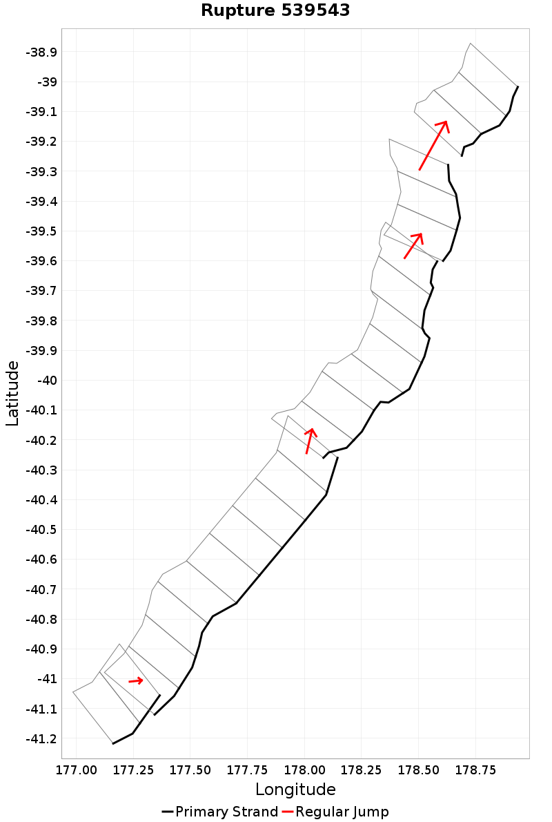
Rupture 539543
| Length (km) | Magnitude | # Subsections | # Clusters | Area (km^2) |
|---|---|---|---|---|
| 313.2 | 7.9 | 24 | 5 | 8,770.5 |
| Maximum Jump Distance (km) | Cumulative Jump Distance (km) | Ideal Length Ratio | Ideal Length Difference | Rake (degrees) |
| 6.1 | 8.9 | 1.1 | 25.9 | -90 |
| Cumulative Rake Change (degrees) | # Mechanism Changes | Cumulative Azimuth Change (degrees) | BS '16-'17 Prob | |
| 0.0 | 0.0 | 459.5 | 0.013520988 |
Text representation:
[488:1939,1940][6:21,22,23,24,25,26,27,28,29][528:2058,2057,2056,2055,2054,2053,2052][578:2250,2249,2248][484:1916,1915,1914]
Fault section list. First section listed is South West relative to the last section.
- Pukeroro Ridge
- 1939, 1940 (jump to 21, 0.9km)
- Akitio Trough West
- 21, 22, 23, 24, 25, 26, 27, 28, 29 (jump to 2058, 1.2km)
- Rock Garden - Ritchie East
- 2058, 2057, 2056, 2055, 2054, 2053, 2052 (jump to 2250, 0.8km)
- Te Kapu Bank East
- 2250, 2249, 2248 (jump to 1916, 6.1km)
- Puke Knoll
- 1916, 1915, 1914