Rupture 138651
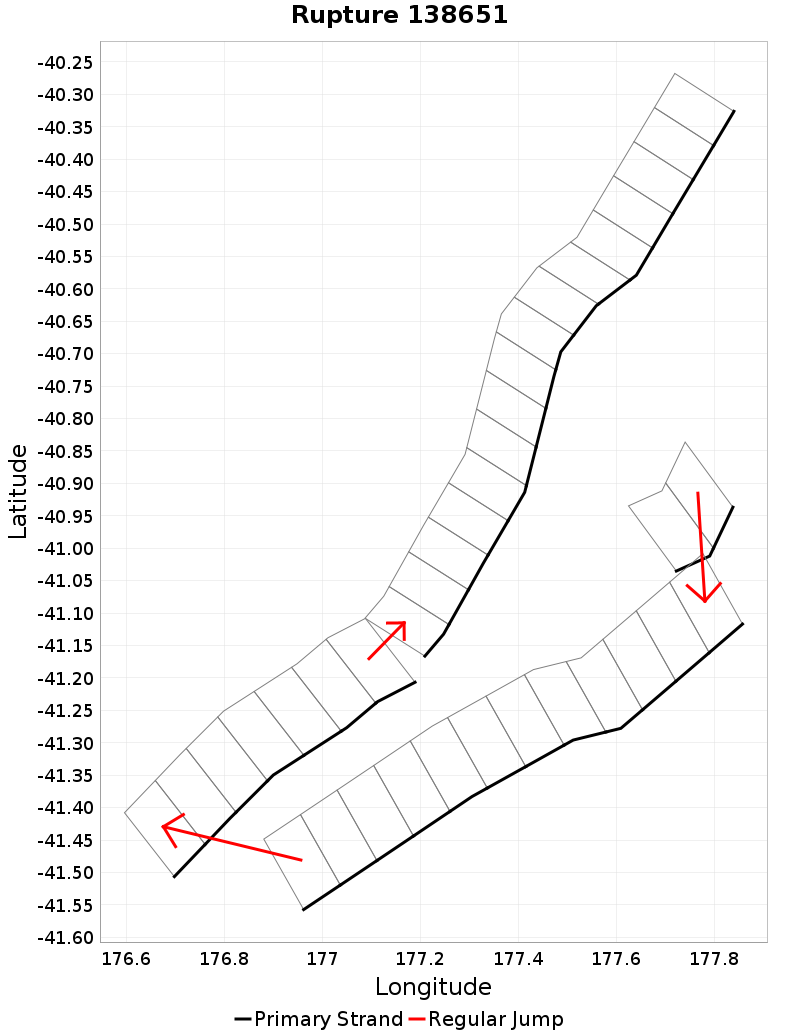
| Length (km) | Magnitude | # Subsections | # Clusters | Area (km^2) |
|---|---|---|---|---|
| 268.2 | 7.5 | 37 | 4 | 4,072.3 |
| Maximum Jump Distance (km) | Cumulative Jump Distance (km) | Ideal Length Ratio | Ideal Length Difference | Rake (degrees) |
| 10.4 | 17.8 | 2.5 | 160.3 | -90 |
| Cumulative Rake Change (degrees) | # Mechanism Changes | Cumulative Azimuth Change (degrees) | BS '16-'17 Prob | |
| 0.0 | 0.0 | 510.3 | 0.003752074 |
Text representation:
[26:212,211][139:881,880,879,878,877,876,875,874,873,872,871,870][488:2763,2764,2765,2766,2767,2768,2769][476:2685,2684,2683,2682,2681,2680,2679,2678,2677,2676,2675,2674,2673,2672,2671,2670]
Fault section list. First section listed is South West relative to the last section.
- Aorangi Ridge
- 212, 211 (jump to 881, 6.5km)
- F17 - South
- 881, 880, 879, 878, 877, 876, 875, 874, 873, 872, 871, 870 (jump to 2763, 10.4km)
- Pukeroro Ridge
- 2763, 2764, 2765, 2766, 2767, 2768, 2769 (jump to 2685, 1km)
- Porangahau Ridge
- 2685, 2684, 2683, 2682, 2681, 2680, 2679, 2678, 2677, 2676, 2675, 2674, 2673, 2672, 2671, 2670