Rupture 549854
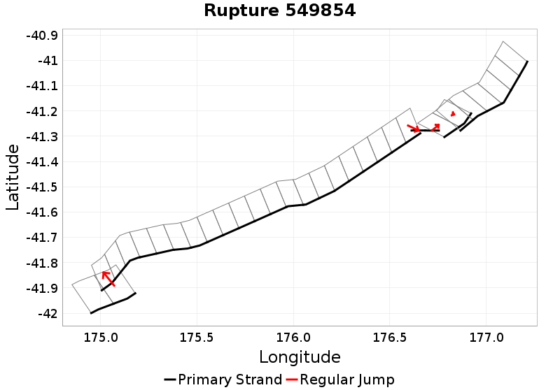
| Length (km) | Magnitude | # Subsections | # Clusters | Area (km^2) |
|---|---|---|---|---|
| 248.6 | 7.5 | 33 | 5 | 3,998.9 |
| Maximum Jump Distance (km) | Cumulative Jump Distance (km) | Ideal Length Ratio | Ideal Length Difference | Rake (degrees) |
| 5.2 | 6.2 | 1.1 | 30.3 | -82.9 |
| Cumulative Rake Change (degrees) | # Mechanism Changes | Cumulative Azimuth Change (degrees) | BS '16-'17 Prob | |
| 225 | 3 | 568.2 | 4.1971358E-5 |
Text representation:
[250:1433,1432][426:2358,2359,2360,2361,2362,2363,2364,2365,2366,2367,2368,2369,2370,2371,2372,2373,2374,2375,2376,2377,2378][613:3420,3421][615:3425,3426][474:2653,2652,2651,2650,2649,2648]
Fault section list. First section listed is South West relative to the last section.
- Kekerengu Bank
- 1433, 1432 (jump to 2358, 5.2km)
- Opouawe - Uruti
- 2358, 2359, 2360, 2361, 2362, 2363, 2364, 2365, 2366, 2367, 2368, 2369, 2370, 2371, 2372, 2373, 2374, 2375, 2376, 2377, 2378 (jump to 3420, 0.4km)
- Uruti Basin
- 3420, 3421 (jump to 3425, 0.3km)
- Uruti East - PorWest 1
- 3425, 3426 (jump to 2653, 0.3km)
- Porangahau Basin
- 2653, 2652, 2651, 2650, 2649, 2648