Rupture 175483
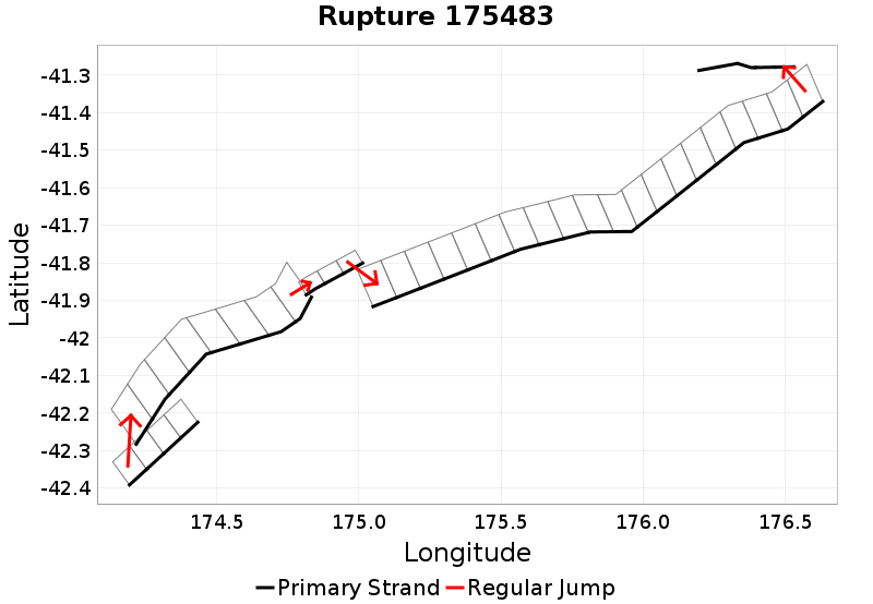
| Length (km) | Magnitude | # Subsections | # Clusters | Area (km^2) |
|---|---|---|---|---|
| 292.5 | 7.6 | 40 | 5 | 4,683.6 |
| Maximum Jump Distance (km) | Cumulative Jump Distance (km) | Ideal Length Ratio | Ideal Length Difference | Rake (degrees) |
| 6.2 | 12.5 | 1.4 | 82.7 | 105.6 |
| Cumulative Rake Change (degrees) | # Mechanism Changes | Cumulative Azimuth Change (degrees) | BS '16-'17 Prob | |
| 50 | 1 | 632.2 | 6.084267E-4 |
Text representation:
[163:973,974,975,976][413:2251,2250,2249,2248,2247,2246,2245,2244][398:2174,2173,2172][303:1695,1694,1693,1692,1691,1690,1689,1688,1687,1686,1685,1684,1683,1682,1681,1680,1679,1678,1677,1676][417:2278,2277,2276,2275,2274]
Fault section list. First section listed is South West relative to the last section.
- Kekerengu Bank
- 973, 974, 975, 976 (jump to 2251, 6.2km)
- Upper Slope
- 2251, 2250, 2249, 2248, 2247, 2246, 2245, 2244 (jump to 2174, 0.2km)
- Te Rapa 2
- 2174, 2173, 2172 (jump to 1695, 4.3km)
- Pahaua
- 1695, 1694, 1693, 1692, 1691, 1690, 1689, 1688, 1687, 1686, 1685, 1684, 1683, 1682, 1681, 1680, 1679, 1678, 1677, 1676 (jump to 2278, 1.9km)
- Uruti Basin
- 2278, 2277, 2276, 2275, 2274